


The Art of Route Planning
And the Excitement It Brings

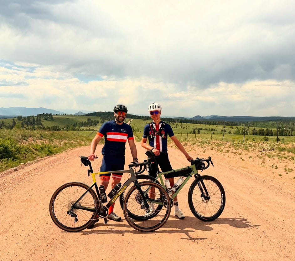
Last weekend, I was fortunate enough to enjoy four days of riding with Noah Leavitt, a great friend and ride partner from back in Massachusetts where my parents live. Normally, we criss-cross the North Shore in the depths of New England stick season around the holidays, bracing early morning chills in the dark, questionable weather, and even more questionable trail choices. Noah has nicknamed my rides “Mehlman Meanders” because I often ride without an exact route in mind. I’ll mix roads and trails together as I wish.
Hosting Noah for the weekend gave me the opportunity to show off the local riding to someone who has seen hundreds (or thousands) of Strava rides and Instagram photos, but has yet to experience Colorado. I say “show off” because there’s a sense of pride I have in showing people the place I live. I don’t know if it’s the same for others, but whether I’m here in Colorado Springs or back where my parents live for the holidays, showing the local riding spots to others is exciting. To me, the local riding areas are like a home. I want to show off my home in its best light. I want to give a tour of my several-million-acre humble abode that shows only the best parts. Let’s skip the laundry room, the unfinished basement, and the messy closet.

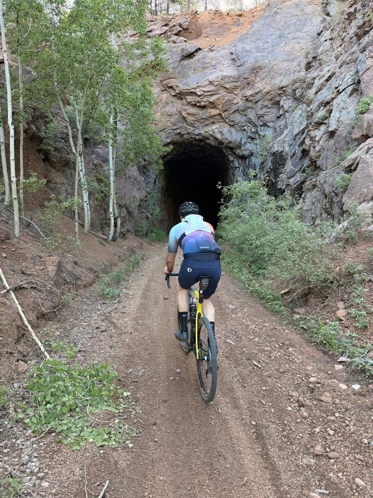
I planned three long and demanding gravel routes for Noah for Friday, Saturday, and Sunday. The first, a loop up Rampart Range Road, down Mount Herman Road, through Monument, and back on the Sante Fe Trail, is one of my favorites. Almost no stop lights or stop signs, almost all dirt, and featuring amazing views east and west, this route never disappoints. The second route, up Gold Camp Road to Cripple Creek and back, brought in some of the local mining history. The final one, out to the northeast in Black Forest and beyond, showed a completely different side of the region out in the plains to the east.
I failed in all three routes. We didn’t complete any of them for a few reasons. As it turns out, going from 0 feet to over 10,000 feet with no acclimation is an almost impossible task, no matter how fit you are, especially if you’re coming from a place where the longest climb is maybe four minutes. Weather caught us out on one day. Busy paved roads to get to the good roads also were a factor on another. I, of course, felt bad that I hadn’t done a better job nailing the route planning, but my failures made me reflect on route planning as an activity.
Building a route for cycling is, on paper, pretty simple. There are ample tools these days to find the most efficient route for commuting, the safest route for families, or the most scenic route for adventurers. The challenge is that route planning is not a science. There is no right answer. Rather, there are an infinite number of possible combinations that are optimal depending on the goal of the ride.
There is also no correct way to approach the problem. Sometimes, keeping oneself somewhat in the dark about what to expect can be fun. Click where you want to start on the Strava route planner, click where you want to end, choose a preferred surface, and see what it comes up with. You’ll almost always be surprised: sometimes in good ways, and other times in bad ways.
There are times when knowing every inch of a route is key. This was important in my previous job. When I was planning routes for clients, I needed to be sure that they were safe, scenic, and manageable for the given fitness level of the group. We used to try to keep all routes to less than 100 feet of climbing per mile on average.
There are also times when route planning is not just about the start and finish points, but about trying to hit certain places in between. For example, I recently planned a route from Manchester, where my parents live, to Boston through Ipswich, Acton, Hartford, Newport, Milford, Northampton, Cambridge, Haverhill, Braintree, Sudbury, Groton, and Boxford. If this sounds like the most circuitous possible route to get to Boston, which is literally visible from Manchester across the water, that’s because this route is between Manchester and Boston in the UK. I’m planning something fun in September, and I got sidetracked and ended up making this route.
There’s something magical about planning routes. It’s as if you can create a painting and then actually go and experience that painting and all its hidden secrets. Route planning is the ultimate freedom and license to explore. It’s a privilege to live in an area where this is possible and to pursue a passion that allows me to explore . As I get more into ultra racing and ultra challenges, I think complex route planning will continue to become something I do more and more.
The idea of route planning really won’t matter if the canvas we can create those routes on, public land, is sliced up for those who want to pay for it. I try not to get “political” on here, but I do not think this issue should be political, since we ALL use public lands for biking, hiking, hunting, fishing, camping, snowmobiling, and so much more. I highly encourage you to contact your Senators to push them to protect our public lands.
Great to see you two riding together!